2/639
)
)
)
)
)
)
)

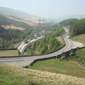
Sutton Oak, looking south-eastwards from Baxter Road overbridge. Straight on was the route of the St Helens & Runcorn Gap Railway, opened in 1833 and closed to passenger services in 1951. The line survived as the link between St Helens Shaw Street station and St Helens Junction station until closure to all traffic in 1989. To the right is the branch to Hayes Chemicals, which closed to traffic in 2002.
- Created on
- Monday 31 July 2006
- Posted on
- Sunday 12 July 2020
- Keywords
- Disused Railway, England, United Kingdom
- Visits
- 2092
- Rating score
- no rating
- Rate this photo